Below is a Map of Shinjuku with the major attractions numbered. You will note the huge Shinjuku station in the centre of the map, it is the busiest station in the world, with JR’s Yamanote line being the most popular with tourist’s. Other rail companies also run services to this station including Tokyo Metro, Toei Subway, Keio and Odakyu, hence the many other stations around the area as well.
Shinjuku’s skyscraper district can be found to the west of Shinjuku Station with Piss Alley to the north of the station on the west side of the tracks. Other attractions here include the Kabukicho Red Light district and Hanazono Shrine in the North East with Shinjinku Gyoen National Gardens and the National Olympic Stadium in South East. The large park you can see the top of in the bottom of the map is neighbouring Shibya’s Yoyogi Park.
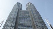
1 Metropolitan Government Building
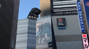
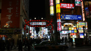
2 Kabukicho
3 Hanazono Shrine
4 Shomben Yokocho (Piss Alley)
5 Park Hyatt (Lost in Translation filmed here)
6 Shinjuku Gyoen National Garden
7 Takashima Times Sq Shopping Centre
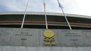
8 Tokyo Olympic Stadium
Train Stations and services in area (Pins A to D)
Shinjuku Station (A)
JR-East:
Yamanote Line
Chūō Main Line
Chūō-Sōbu Line
Shōnan-Shinjuku Line
Saikyō Line
Tokyo Metro:
Marunouchi Line
Toei Subway:
Toei Shinjuku Line
Toei Oedo Line
Keio Corporation:
Keiō Line
Keio New Line
Odakyu Electric Railway:
Odakyu Odawara Line
Shinjuku-Sanchome Station (B)
Tokyo Metro:
Marunouchi Line
Toei Subway:
Toei Shinjuku Line
Sendagaya Station (C)
JR-East:
Chūō-Sobu Line
Tochomae Station (D)
Toei Subway:
Toei Oedo Line